THE JELASNICKA GORGE

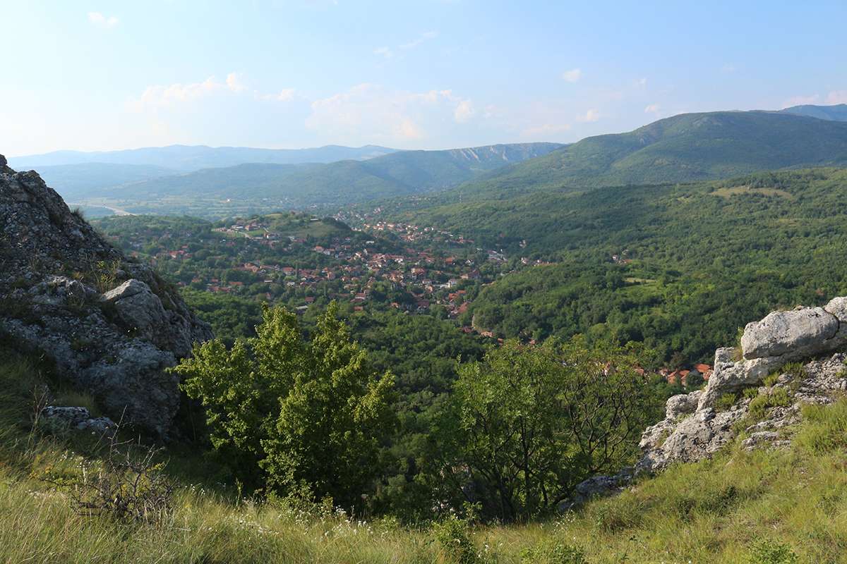
The road from Gornja Mala, part of Jelasnica, to the top of the gorge is marked with mountaineering signs. The Mining Colony can be seen in the village, because there was a brown coal mine nearby, which operated from 1920 to 1967. There were also single rooms and family sections in the colony. The train Cira drove coal from Jelasnica to Niska Banja. He also had one passenger car, because there were no buses and cars. A tram went from Niska Banja to Nis.
In Sicevo is the church of St. Elijah, which is dedicated to the holy prophet Elijah, and was built in the 19th century. Within the gorge there are 4 windows, one of which is the window of St. Or is. Next to the window, on the eastern part of the gorge, is the Tsar’s trough. There is a legend that from the western to the eastern part of the gorge, people crossed the canvas towards the Emperor’s riverbed. It is about 3 km long, starting from Jelasnica and moving along the valley of the Jelasnica river. In the gorge there was the monastery of St. Archangel Michael, which is thought to have been built in the Middle Ages in a hollow in the rock. There was a path to the monastery, but it eventually collapsed, after which it was demolished, so now there are few traces of the past. There were several fortifications at this place, because the road from Nis to Pirot has passed here since the time of Emperor Constantine. The fortifications protected the inhabitants from other peoples. There were over 15 monasteries in the Jelasnica and Sićevačka gorges. Places where monasteries and water sources existed were successfully found.
In the village of Manastir in the gorge there was a monastery dedicated to St. Fridays. Jovan Cvijić visited the Jelasnica gorge in 1892/93. He included two photographs from the gorge in his most important work “Balkan Peninsula”. It was first printed in French in 1912, and only later was it translated into Serbian. The dry mountain was once called Kunovica, and it was named after the Kun tree, which dominated the mountain. Today’s name Suva planina came from the fact that there are no springs at high altitudes. The water from the top goes through cave channels and springs only at the foot, where there are various springs, such as: Vitansko vrelo, Krupajsko vrelo, Krupničko vrelo… Water from these springs is very useful for the surrounding population. The first spring for Nis was in Gornja Studena, and later a water supply system was built, which is still in function.
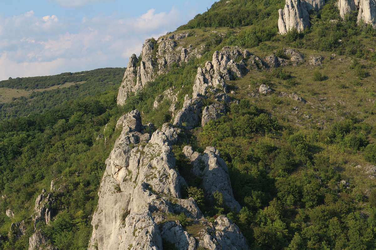
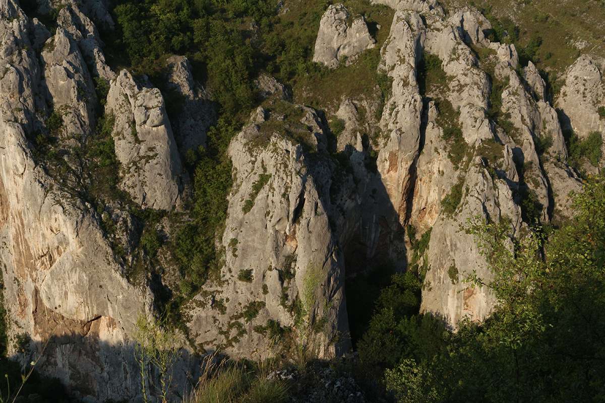
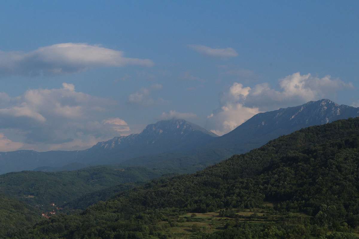
From Nis to Pirot and further to Constantinople, the oldest Roman road Via militaris led. On that road there were stops called khans, so there is also Jelasnicki khan. The inns go along the valley of the Kutina river to Gadžin Han, which was also a station. The road through the gorge was made in the 19th century, and until then the path was crossed. Here is the Ripaljka waterfall, which dries up during the summer. Above the waterfall is the Čukljenički window. The dry mountain dominates the forests, while the southern side towards Zaplanje has been cleared to make pastures for storing and grazing cattle. This is a karst and limestone mountain. From the Jelasnica gorge, you can still see the mountain Kalafat, Kamenicki vis, the beginning of the Sićevačka gorge, where the village of Prosek is located. From the ridge of the Jelasnica gorge, you can see the ridge of the Svrljig mountains called Ječava. There is a Kolo kamen on it, which originated from the old Slavic word for Sun, Sunce, so it is translated as The Sun Stone.
The Jecava cave with a high entrance is part of the Svrljig mountains. The hill on the part of Suva planina is called Kunovicka Surface, where there are as many as 15 rare species of plants, among them sage, and winter chubar from which Rtanj tea is harvested. Iva grass, Hajducka grass and Vranilova grass are also found in that rock. They thrive in this area due to the altitude of 500 to 600 meters. There is a hiking trail that leads from the school in Jelasnica to the highest part of the Jelasnica gorge called Radov kamen, 580 meters high. The Jelasnica River and the Jelasnica-Studena-Cukljenik road flow through the gorge at 300 meters above sea level. From the top of the gorge you can see the peaks of Suva planina: Crni kamen, Sokolov kamen, Devojacki grob and Trem. The Jelasnica gorge used to be full of vineyards. This place was known for the sale of grapes in Zagreb and Ljubljana, where it was exported until the 90s. Today they are neglected.